Do you live above an earthquake fault or make your home in a place at risk of burning in a wildfire? Do you regularly travel through areas prone to flooding or considered at risk of landslide? What could you expect if the Glacier Peak volcano erupted?
Snohomish County’s dramatic landscape was shaped by powerful natural forces that are active still. Living here means living with the potential for natural disasters.
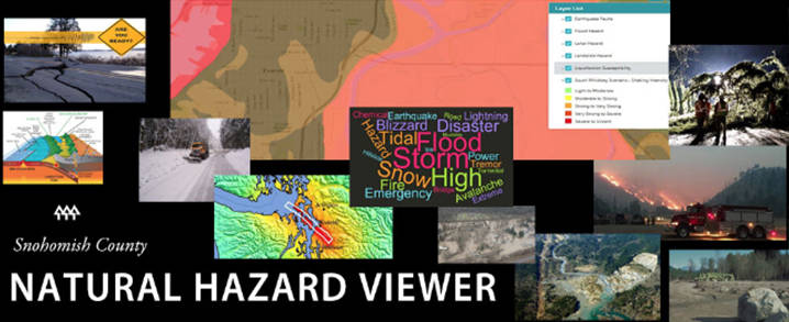
The first step towards becoming prepared is to recognize and understand the risk. The Snohomish County Hazard Viewer is a new online tool designed to make that simple.
“This easy-to-use viewer provides information our residents can use as they make preparedness plans for themselves and their families,” said Jason Biermann, Snohomish County Emergency Management Director. “Prepared individuals, families and businesses form the foundation of our county’s resilience to disasters.”
The hazard viewer builds on planning done by county emergency managers to identify and mitigate natural hazard risks. It mixes digital maps and data in a searchable, interactive format so you can learn more about the potential hazards where you live and work, as well as along your commute and the many other places life takes you, including schools, stadiums, shopping areas, hiking trails and campgrounds.
The viewer is designed to encourage exploration.
It’s possible to click on the maps and zoom in to learn where earthquake faults run under local roads and bridges. You can see the path deadly lahars may run in the unlikely event volcanic activity suddenly melts the ice now cloaking much of Glacier Peak. You can type in an address and retrieve a full menu of known natural hazards for that location, including a prediction of the shaking that can be expected the next time the South Whidbey Island Fault lets loose.
People in the region are justifiably concerned about a mega quake along the Cascadia Subduction Zone off the Washington Coast, but the South Whidbey Island Fault is a big concern closer to home. It runs below much of south Snohomish County.
The hazard explorer displays the best estimate for how the county would be rattled during a shallow magnitude 7.4 event along that fault. Planners estimate it likely would cause $12.8 billion damage and leave more than 5,000 people here in need of short-term shelter.
The hazards viewer contains links to checklists and tips, but its real power may be in the questions it prompts.
How many bridges do you cross to reach your job or kids’ school? How would you travel if those routes were blocked? Where would you go, or have your loved ones go, if staying put for a time is the only option? Do you know where your food, water and medicine would come from if the stores aren’t open or roads were impassable for up to two weeks?
The hazard viewer was developed through a collaboration between the county’s departments of Emergency Management and Information Technology. The Snohomish County PUD also joined in, allowing inclusion of the utility’s real-time power-outage map.
Windstorms that topple trees into power lines are the most-frequent natural hazards events in the community. In many homes, it is a rite of autumn to check that flashlight batteries are fully charged and the pantry stocked with extra food.
Preparing for winter storms is part of the fabric of living here. So, too, should be getting ready for other hazards.
Learn more about Snohomish County’s natural hazards: https://bit.ly/2AKEbhH


